Monthly Archives: March 2009

OSM WordPress plugin

Michael Kang writes:


faktor is a group of photographers, we started an open photoproject in 2004, to collect one photo for each location. Last month we decided to add geo data and geo links on this site. To handle this I wrote a plugin and after some lines I thought it could be usefull for others, too.

To add a map into your wordpress blog you just have to install the plugin and use the shortcode like:

[osm_map Lat=”37.5665″ Long=”126.9779″ zoom=”5″ width=”450″ height=”300″]

in your post/page (no configuration is needed).

Details and the plugin is here:

http://www.Fotomobil.at/wp-osm-plugin

Also see geopress

SOTM needs a logo!

From stateofthemaporg:

The SOTM working group is pleased to announce a call for logo designs. Our existing logos have served us well and the time is right to look further afield to make sure we have the best design possible. We’ve put together a Design Brief which outlines what we’re looking for in a logo. We invite you to either build a logo yourself, rope in some friends/co-workers or use a site like elance.com and a spare £/$/€50 and get a freelancer to have a go.

The logo must be licensed CC-BY-SA and received by email within two weeks (by midnight Wednesday 8th April UK time). The team will decide by vote the logo to go with.

The winning entry will be rewarded with a full weekend ticket to SOTM!

The SOTM team can’t wait to see your entries!

The Crowd Sourced Approach Gathers More Supporters

The Geographers, GIS buffs and spatial analysts at UCL have always been big supporters of OpenStreetMap.  Over the last few years more and more of their attention has been turning to the study of crowd sourcing as a way of creating geographic information.  One great example of applying academic research to OSM is Muki Haklay’s 2008 OSM Quality Evaluation work, in which Muki compared OSM data to data sets produced by the UK Ordnance Survey (OS) – the UK Government body charged with mapping the UK.  The OS has a fierce reputation for for producing some of the most accurate and most detailed maps in the world, so its impressive to hear that: “The positional accuracy [of OSM] is about 6 metres, which is expected for the data collection methods that are used in OSM. The comparison of motorways shows about 80% overlap between OSM and OS…”.  Of course OSM moves quickly – there are now more than 100,000 OSMers around the world compared with 35,000 this time last year – so when I spoke to Muki earlier this year I was excited to hear that there is more OSM data analysis on the way.  Watch this space and in the meantime, take a look at this recent presentation.

A team of UCL Geographers are taking their interests in crowd sourcing on the road, speaking at the American Association of Geographers annual meeting in Las Vegas next week (22nd – 27th March).  Papers include: “Neogeography: Crowdsourcing and Mapping for Masses” – something that should be of interest to any OSMers in the area.  Another interesting looking title comes from TeleAtlas Chief Scientist Don Cooke talking about “Neogeography and Crowdsourcing: the View from a Walled Garden“.  I got the opportunity to talk to Don after giving a presentation about OSM and crowdsourcing at last year’s Where2.0 conference.  He was a big fan of OSM and the crowd sourcing model.  One thing’s for sure – the often distainfuly labelled “paeleo” generation are not going to roll over and die.  Guys like Don Cooke or the UCL geographers are veterans of an industry that has created vast data sets, empowered millions of people to make better decisions, as well as creating companies with multi-billion dollar price tags.

How will OpenStreetMap react when the “walled garden” approach to crowd sourcing puts the power to edit and create maps in the hands of everyone with a mobile phone or a sat-nav?  To make sure that the open approach to crowd sourcing keeps on producing data sets that can be favourably compared with those of the walled gardens we need to keep one step ahead.  Learn from the acheivements and mistakes of companies like Tom-Tom, who are embracing crowd sourcing.  Openess alone isn’t going to build a free world map.  We need to expand the reach of OpenStreetMap – attract 900,000 more mappers in more places of the world and help them produce better maps.

OSM passes 100,000 users!

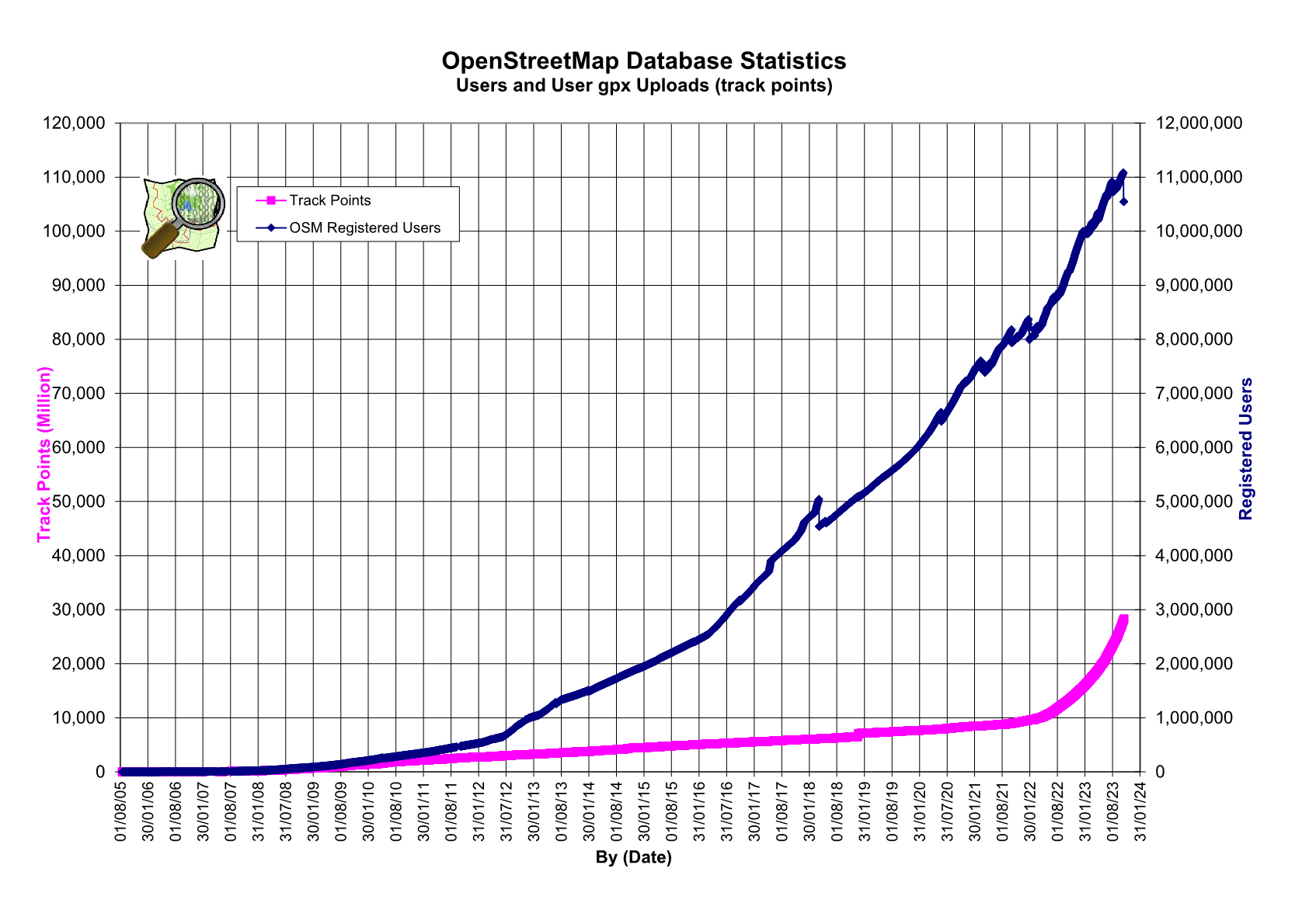
A great day for celebration! Sometime during Monday 16th March 2009 OpenStreetMap gained it’s 100,000’th registered user account!

It’s been a fantastic journey since 9th August 2004 when User:Steve registered the domain and started the project. Today we have a fantastic set of sysadmins keeping the OSM clockwork going, brilliant developers and a massive and stunning community building… the map.

Our map goes from strength to strength with such fantastic detail being built it’s unreal. Check it out!

Now, roll on our 1,000,000’th user please! Help OSM get there by submitting a talk to our upcoming conference – it’s going to be a blast!

Call for Papers for the StateoftheMap 2009 is now open

What are the burning OpenStreetMap issues that you want to talk about?  Have you been working on the next killer OpenStreetMap application?  Have you been promoting mapping and opengeodata, holding mapping parties and tirelessly mapping in the sun, rain, wind and snow?

The call for papers for the third international StateoftheMap conference is now open.  The OpenStreetMap Foundation invite contributions from mappers, geo-hackers and open geodata supporters around the world.  If you are involved in OpenStreetMap mapping, coding or community organization – or if you want the chance to present your ideas or opinions to the OpenStreetMap community, you should submit a paper to the StateoftheMap 2009.

Themes for 2009 are:

OSM 2010 –
Taking OSM from 100,000 to 1,000,000 contributors

OpenStreetMap has come a long way in a very short space of time.  With 100,000 contributors all around the world, OpenStreetMap has its future ahead.  But there are also some big challenges ahead.  How can OpenStreetMap continue to support new mappers around the world?  How can the successes of mappers from well mapped countries be repeated in the unmapped world?  What will a community of 1,000,000 mappers look like and what technical infrastructure needs to be put in place to support OSM’s growth?  What are the new challenges that the OSM community must rise to in order to attract more mappers from diverse cultural backgrounds?  What lessons can be learned from other open-source and open content communities who have made the transition from bedroom projects to world renowned successes?

New Mapping Frontiers – Expanding OSM into new communities, new regions and mapping new features with OSM

OSM started with some roads and footpaths in central London and now includes 1000s of different types of geodata around the world.  As OSM continues its goal to provide a free map of the world, where will the line be drawn between “mappable” and “unmappable”.  The third and fourth dimensions, indoor mapping and historic mapping are all there for the taking.  What about aerial imagery?  Will UAVs and community contributed aerial data provide detailed, open datasets?  Is there really such a thing as “ground-truth”, or is all mapping subject to interpretation?  What about subjective data: where do reviews, ratings and personal opinions fit in the OSM database?  As OSM is taken up by new communities, what are the cultural barriers that need to be broken to make sure that new mapping frontiers are crossed?

OSM Application Development – Building applications that use the OSM APIs

OSM’s APIs provide a great base for all kinds of application development.  What are the killer apps of 2009?  Will this be the year of the OSM Mobile Editor?  How can OSM’s trailblazing cartography continue to break new ground?  What are the “enterprise” tools and services that are bring OSM maps to new users around the world?

Tools Tips and Techniques – Practical workshops that take a deep dive into a specific area of OSM

Are you power user of an OSM tool?  If you’d like to share your expertise with OSM editors, cartography tools or OSM APIs, you can propose a session to host.  Maybe you want to learn more about a particular area of OSM – if so you can also request a session to be given.

Session Formats

  • Talk – present your paper in either a 15 or 30 minute slot with time for questions afterwards
  • Discussion Sessions – Groups of 5 – 15 people hold an informal group discussion of a special interest topic
  • Lightening Talks – 5 minutes to say your piece.  Sign up on the day
  • Workshops – 2 hour sessions that give OSMers the chance to take part in an in depth tutorial

The call for papers closes on the 3rd May 2009, so you have just over 6 weeks to get your abstracts in.  A provisional program will be published in mid May 2009.

To submit your paper, follow this link.  If you need any more information about submitting a session, contact Nick.

To register for the StateoftheMap 2009, click here.