So my birthday is usually a total waste of time because it’s very close to Christmas Day. It means two-in-one presents that are a bit rubbish and everyone’s gone to somehwere better for the holiday, but this yeah I got an awsome present:
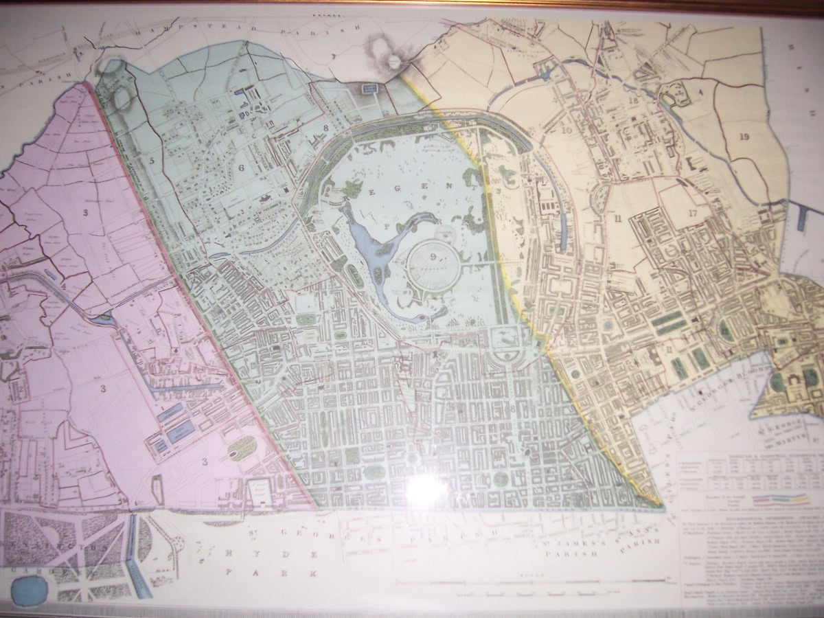
It’s a map of central London, approximately similar to this openstreetmap. I used to stare at it whenever I went past the antiques shop in central London (it was on my way home) it hung in. I even tried to buy it once but then thought I was a bit mad and didn’t as I could buy a low-end laptop for the price. It’s about a meter and a bit across by about half a meter down. It’s framed in gold leaf and is original, though I’m unsure exactly what that means in this context.
There are a few things I like about this. Firstly, it’s where I used to live on the western rim of Regents Park. The building is in the map (dated 1834), along with favourite haunts and most of my paper round(s). It also has where I (nominally) went to university and several other places I lived, pubs I’ve died in. So I know the area fairly well and it’s nice comparing it to what it looks like today.
I like the wave of development. If you look at Regents park and then east and west of it along a parallel, you can see a wave of development heading northward turning farmland in to London. A lot of rich people were made as these fields were built upon and their great-great-great (* some big number) grandsons still own vast chunks of it.
It’s slightly later than the periods of history that I like to read about but still very related map-wise. It reminds me of openstreetmap. OSM is incomplete and expanding to conquer everything that is un-mapped – you can see a freeze-frame of our map by just browsing it today. Similarly, the map shows a freeze-frame of those same streets being laid down in the first place as they swallowed up villages to build London.
I have no idea if or how it could be scanned in but I’m open to ideas. A lot of the map is vastly different (Paddington, Marylebone, Euston and Kings Cross stations arn’t there for example!) so I havn’t used it (much) for deriving street names. Interesting anyway.
So a big thank you to all who bought it for me 🙂