I’m not entirely sure what axismaps.com does but it sure seems to
involve a lot of pretty maps. This caught my attention when pointed
out to me by OSM contributor RichardF.
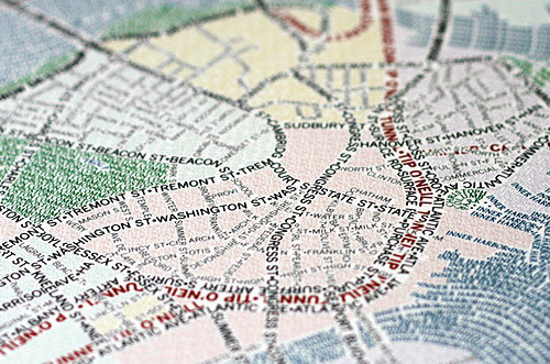
These unique maps of Chicago and Boston accurately depict
the streets and highways, parks, neighborhoods, coastlines, and
physical features of the city using nothing but type. Only by manually
weaving together thousands upon thousands of carefully placed words
does the full picture of the city emerge. Prints are
available.
So, Boston and Chicago, but I’m told that San Francisco, New York and
Washington are in progress, too.
See more pretty maps and wonderful photography of maps on their web site.
http://www.axismaps.com/typographic.php
They have a blog entry describing the process of creating these maps, as well.
http://www.axismaps.com/blog/2010/09/typographic-map-posters/

