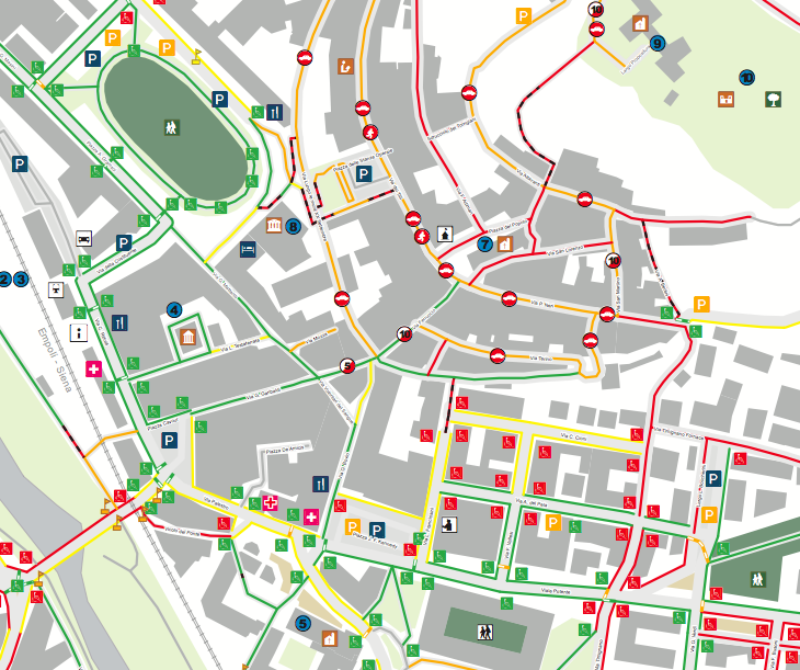
This is an extract of the printed paper map of urban accessibility of
Castelfiorentino. The printed paper map is a static view of urban
accessibility as the 30th of August 2010 and it is one of the outcomes
of the participatory process “Libero accesso…accesso libera
tutti!!”. The full printer map file is here The up-to-date
accessibility map is published on the web at accessoliberatutti.it
where participant and citizens can keep contributing. Further
information and several links are available on the project page:
http://wiki.openstreetmap.org/wiki/Libero_Accesso…Accesso_Libera_Tutti!
This is a Featured image, which means that it has been identified as
one of the best examples of OpenStreetMap mapping, or that it provides
a useful illustration related to the OpenStreetMap project.
If you know another image of similar quality, you can nominate it at