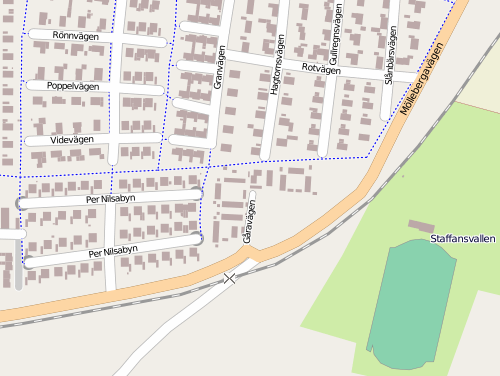
Building outlines in Staffanstorp, Sweden courtesy of the town council
GIS. Uploaded by OSM user lorimar who works in the Staffanstorp
municipality GIS office. You can find Staffanstorp on OSM here.
http://www.openstreetmap.org/?lat=55.6427&lon=13.2117&zoom=14&lay…
Staffanstorp is doing some interesting things with OSM data. Have a
look at the multi-modal router they have, as well. It is a
comparative router that shows recommended routes for pedestrians,
cyclists, driving and public transit, along with the costs in time,
calories and carbon! Very nice, lorimar.
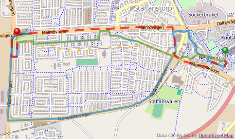
Be sure to switch to display the OSM data layer, it’s much more
detailed than the proprietary data layer. the comparative router was
developed by Staffanstorp’s neighbour, the municipality of Lund.
http://www.lund.se/
http://kartor.lund.se/resejamforaren/start_st.htm
This is a Featured image, which means that it has been identified as
one of the best examples of OpenStreetMap mapping, or that it provides
a useful illustration of the OpenStreetMap project.
If you know another image of similar quality, you can nominate it at
Looks like the link was broken for a few minutes. Should be fixed now. Sorry.