Monthly Archives: September 2010

Usabilla shoutout

I want to give a shoutout to usabilla.com who’re helping OpenStreetMap with visual feedback on our user experience testing and design.

The concept behind usabilla is super simple, throw anything from full fledged designs to mockups in front of potential users and get click-based feedback. Users get to click on things and leave notes around specific features and parts of a page. So rather than trawling through a list of feedback, you get a more visual and engaging experience from both the testee and the testers perspective. And a whole lot more, check out the intro video below:

[youtube http://www.youtube.com/watch?v=d6Xi8IdQLik?wmode=transparent]

OSM User Testing

I’ve written previously about OSM usability studies, and now it’s happening. Nate Bolt from the fantabulous Bolt|Peters is going to help OSM run usability tests and we need your help.

The timeline looks something like this: This week or next we’re going to switch on some javascript on the OSM signup page that invites a percentage of signups to help OSM run a user survey. Those people fill out a form and are invited later to use some simple online screen capturing software while asked to do some simple tasks and this is where you come in. We need to think of some simple tasks for new users to complete, and we’ll put them together over on this wiki page. Add a street? Find a mailing list? Add a point of interest? What should they do? That’s up to you.

Also, if you’re running a mapping party we can give you a super secret link where you can send new users to do the same tasks with screen recording. You mustn’t help them on the first go, as that’s exactly what we’re trying to find out – what goes wrong.

Then on December 8th (tentative) at the Bolt|Peters office in San Francisco, OSMers together with the UX wizards will analyze the videos and make some joint suggestions on how to push things forward. Anyone in SF, or can be in SF around then, please drop me a mail.

Project of the Month: Drinking Water

How about a nice drink of water? Refreshing on a warm day, especially
nice when one has worked up a sweat by collecting information for
OpenStreetMap. We can sometimes forget that we need water to live.
Sadly, not everybody can take for granted reliable access to safe
drinking water.

On 28 July 2010, the UN General Assembly adopted a resolution that
declares “the right to safe and clean drinking water and sanitation as
a human right that is essential for the full enjoyment of life and all
human rights.” In 2005, more than 3.5 Million people died of
water-borne illness.

This Project of the Week is also the first Project of the Month. Add
drinking water locations to the map. In some places we’ll be adding
public water fountains as a courtesy to outdoor exercisers, in others
we’ll be adding the critical public water access points.

Put drinking water on the map.

Find out more about how to add drinking water locations to
OpenStreetMap on the project wiki page.

http://wiki.openstreetmap.org/wiki/Project_of_the_week/2010/Sep_29

This is the first Project of the Month. Project of the Week returns
next week, while PotM will continue until November. These projects
inspire mappers to contribute data they might not have considered
previously, and allow us to be inspired by the projects of other
mappers.

This is your Project of the Month. Make suggestions. Inspire other
mappers. What is it about contributing to OpenStreetMap that
interests you? Postboxes? Bowing alleys? Share your OpenStreetMap
obession by contributing a Project of the Month.

http://wiki.openstreetmap.org/wiki/Project_of_the_week/Proposals

Water glass photo by Kyle May http://www.flickr.com/photos/kylemay/
is licensed CC-By http://creativecommons.org/licenses/by/2.0/deed.en

Image of the Week: Merida Venezuela

Media_httpimgurcomdx4_wpbce

OSM map of Merida, Venezuela. Data by Fundacion GeoHorizontes de
Venezuela. Data collected by HernanRamirez.

This is a Featured image, which means that it has been identified as
one of the best examples of OpenStreetMap mapping, or that it provides
a useful illustration of the OpenStreetMap project.

If you know another image of similar quality, you can nominate it at

http://wiki.openstreetmap.org/wiki/Featured_image_proposals

Mapnik Code Sprint: Committers and Cartographers

Media_httpimgurcombl1_lrlcn

The first Mapnik Code Sprint, dubbed Committers and Cartographers, got
underway a few hours ago, during the English morning. After a few
hours of introductions, background discussion, planning and lunch, the
audio feed has been reduced to the tapping of keyboards. As the
voices became less frequent, the updates on the #mapnik IRC channel
became more frequent with changesets and trac comments in abundance.

So the code sprint has started in earnest now.

A code sprint is an in-person meeting to collectively tackle
programming problems that are more difficult to solve individually.
Committers and Cartographers is focusing on removing bugs from the
current Mapnik code base, adding advanced cartography features and
planning for the next releases of Mapnik.

Attendees have traveled to London to participate from as far away as
Ukraine, USA and even Charlbury. Online participants are expected,
time zones permitting, from many other countries as the code sprint
continues this weekend.

Mapnik is a map rendering library that is used to create map images
from geographic data. Many web sites use Mapnik to render
OpenStreetMap data including the main OpenStreetMap web site which has
a layer called Mapnik.

Committers and Cartographers is only possible because of the generous
donation of time and expertise of each of the participants. Thank
you! We can’t wait to see all of the improvements in Mapnik.

Thank you, CloudMade, for hosting the Mapnik Code Sprint in your
London office.

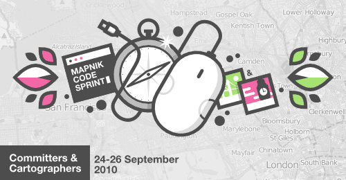
Thank you Development Seed, for the awesome Committers and
Cartographers logo. The logo is © 2010 Development Seed,
OpenStreetMap and Contributors and is licensed CC-By-SA.

MapQuest adds four more Open countries and an OSMer.

Media_httpeutechcrunc_bdsik

MapQuest announced a beta open map using OSM data and tools from the
OSM stack during State of the Map in July 2010. The initial
announcement was only for England, but you could still see that they
had the full OSM planet available at the http://open.mapquest.co.uk
address.

Now they have announced the domains for Spain, Italy, Germany and France.

In July MapQuest also announced that they were earmarking $1 Million
for investments that will improve OSM data in USA. They have now
hired somebody to manage that investment fund, and it is OSM
contributor Hurricane Coast.

See the details in the press release and coverage on TechCrunch Europe.

http://eu.techcrunch.com/2010/09/23/mapquest-openstreetmap-europe/

http://company.mapquest.com/2010/9/23/mapquest-continues-to-open-up/

Measuring the OpenStreetMap Economy

When I see announcements flying around like MapQuests $1M commitment to OSM, or CloudMades $12M VC round it begs the question of how big is the OSM economy?

Purely as an academic exercise it’s interesting to think of OSM as an ecosystem around which people find work and provide goods and services. But also perhaps it would be a nice exponential graph to show as a slide along with user growth.

We have some limit cases. In 2004 when founded, the economy was approximately zero. Or was it? Do we measure volunteer hours? How about the power and bandwidth the servers are burning? Or is that negligible compared to the other large numbers thrown around?

Today I would estimate we have about 5 people freelancing on OSM work worldwide. Perhaps 50 that do OSM work as part of their job, say writing a plugin or using the data. Full-time employees working explicitly on OSM? Perhaps 50 again. These are all guesses with some rough education behind them. These numbers would probably follow the kind of growth curves that various projects around linux did, rather than wikipedia I’m guessing. Because wikipedia was much more about the destruction of value around britannica and others, and the secondary service and otherwise market around wikipedia is pretty small (I think?). Unless you count MediaWiki itself.

Once you have the criteria of what goes in to the measuring pot of the “OSM economy” you further have large error bars on the data for each thing. For example, are those freelancers going to tell you what kind of money they’re making?

Still, an interesting thought exercise.

Project of the Week: Meet a Mapper

Media_httpimgurcom2q0_eaihb

Contributing to OpenStreetMap is a collaborative activity. We each
submit data knowing that our personal data becomes our collective
data. At times we hope that our contributions will be seen as
acceptable and good enough. At other times we hope that other mappers
will help us refine and improve our contributions. As much as
OpenStreetMap is a group project, often we each make our contributions
in isolation.

This isn’t always the case. We have Mapping Parties and Stammtisch and
meetups and various social tools to contact and connect with other
mappers.

The Project of the Week is to meet another mapper in some way.

Some of us prefer to meet virtually. Others like to meet face to face.
Still others like to organize and facilitate. Participate in a way
that you feel comfortable. When meeting people in person for the first
time, take reasonable precautions.

You’ll find suggestions for meeting other mappers on the Project of
the Week wiki page:

http://wiki.openstreetmap.org/wiki/Project_of_the_week/2010/Sep_22

This is your Project of the Week. Make suggestions. Inspire other
mappers. What is it about contributing to OpenStreetMap that
interests you? Postboxes? Bowing alleys? Share your OpenStreetMap
obession by contributing a Project of the Week.

http://wiki.openstreetmap.org/wiki/Project_of_the_week/Proposals

Hey!? What’s going on? Is it the weekend already?

No, it isn’t the weekend already. Project of the Week has moved to
mid-week based on user feedback. Stay tuned also for the first
Project of the Month. It will be announced next Wednesday.

Mapping party photo by Russ Nelson