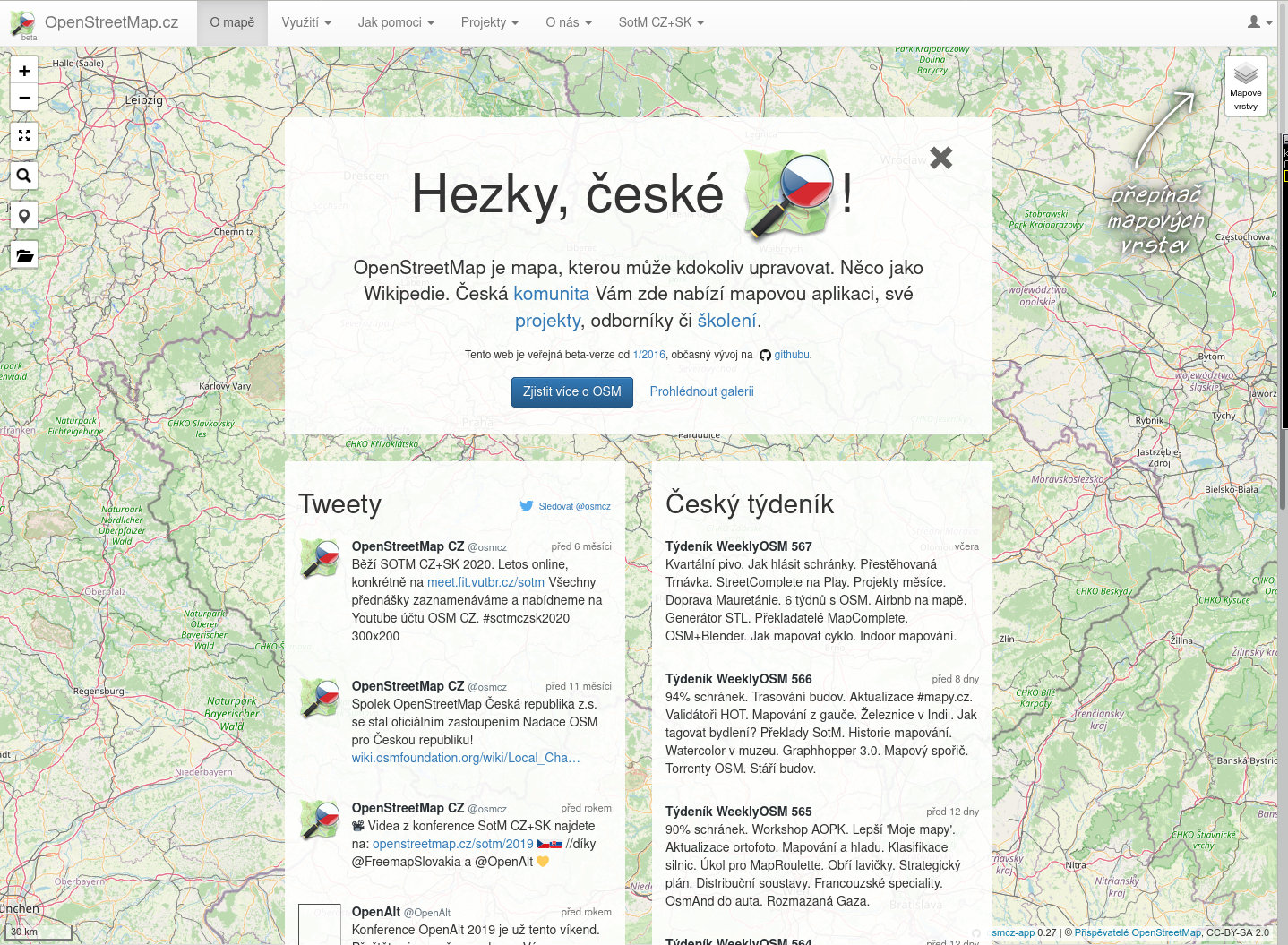
The following post was put together by several members of Czech OSM community, and the main contributor was Mikoláš Štrajt. OpenStreetMap Česká republika z.s. is one of the OSM Foundation Local Chapters.
OpenStreetMap Česká republika z.s. association was founded in 2018 with a primary aim to have a stable entity for ownership of already existing website of the local community on domains openstreetmap.cz and osmap.cz. Since 2020 the association acts as a local chapter of OpenStreetMap Foundation in the Czech Republic.
automatically, address points (operated by poloha.net project),
semi-automatically, buildings (from the RÚIAN database) and fields and meadows (from the LPIS database) using the JOSM plugin called Tracer,
we are updating post boxes according to open data by Česká pošta (Czech Post) and we report any discrepancy found,
as needed, we sometimes do collective edits. Recently, we have been for example improving the tags about recycling containers or controlling if we do not have telephone booths, which were cancelled the other day, hanging in the map.
organise the State of the Map CZ+SK conference (as part of wider OpenAlt conference or standalone action), and we are publishing video recordings of the speeches,
quarterly, call for a personal meeting of mappers – so-called “quarterly beer”,
organise mapathons,
clean up after vandals operating in the area of the Czech Republic, communicate with the newbies, state offices, and commercial subjects.
Members of our community operate their own projects, e.g.:
– MTB map – a map for mountain bike riders, – tourist maps for Garmin, other Garmin maps, – maps of the Czech Republic for applications based on the mapsforge library, – POI importer used to easily import various datasets into OSM, – Osmose backend for CZ,PL,DE,FI,DK,AT, – Taginfo for the Czech Republic, – OsmHiCheck – QA applications for hiking routes, – Archive of extracts of OSM data for the Czech Republic with very old versions, – Monthly generated map tiles for the Czech Republic starting 04.2006.
Do you want to translate this and other blog posts in another language..? Please send an email to communication@osmfoundation.org with subject: Helping with translations in [language]
The OpenStreetMap Foundation is a not-for-profit organisation, formed to support the OpenStreetMap Project. It is dedicated to encouraging the growth, development and distribution of free geospatial data for anyone to use and share. The OpenStreetMap Foundation owns and maintains the infrastructure of the OpenStreetMap project, is financially supported by membership fees and donations, and organises the annual, international State of the Map conference. It has no full-time employees and it is supporting the OpenStreetMap project through the work of our volunteer Working Groups.
OpenStreetMap is open data, available to all for free on https://planet.openstreetmap.org. We release six large files, totaling 428 GB every week. These files contain the complete OpenStreetMap data, including files with the full history of OSM.
To make it easier to share the load of downloading these files, we also supply BitTorrent files, which allow spreading the load across multiple web servers as well as using peer-to-peer file transfers.
mnalis has recently implemented RSS feeds which announce when the torrents come out. This allows users to automatically subscribe to sharing new planet files as they are produced, thus reducing the load on the planet.openstreetmap.org servers, which are bandwidth-limited.
Do you want to translate this and other blog posts in your language…? Please email communication@osmfoundation.org with subject: Helping with translations in [your language]
The OpenStreetMap Foundation is a not-for-profit organisation, formed to support the OpenStreetMap Project. It is dedicated to encouraging the growth, development and distribution of free geospatial data for anyone to use and share. The OpenStreetMap Foundation owns and maintains the infrastructure of the OpenStreetMap project, is financially supported by membership fees and donations, and organises the annual, international State of the Map conference. The OSMF supports the OpenStreetMap project through the work of our volunteer Working Groups, such as the Operations Working Group. Please consider becoming a member of the Foundation.
iD is the editor through which 80% of OpenStreetMap users contribute to the common edifice. The OpenStreetMap Foundation is committed to its support and seeks to staff iD development.
iD development is a funded position with the OpenStreetMap Foundation, with remuneration at market rates according to skills and commitments.
Please submit your application to board@osmfoundation.org. Include CV, cover letter, and/or examples of work as attachments. Also please indicate your preferences of full-time or part-time, work location, contractor status, and anything else we should consider.
What we are looking for
iD development involves a wide range of roles that may be held by one single polyvalent person – or by more than one, with skills and motivations that complement each other.
The overarching concern will remain addressing and balancing the needs of a diverse range of stakeholders, including:
iD mappers and OpenStreetMap community members from around the world
Corporate and non-profit players in the OpenStreetMap space
Downstream forks and instances of iD
Peer projects that rely on components of iD, or that iD relies on
Project management responsibilities will put an emphasis on communications:
Foster a welcoming, professional, online public space
Maintain and communicate a project roadmap based on input from stakeholders
Gather feedback and build consensus around major changes
Host regular online audio/video meetings to give updates, receive feedback, and hold discussion
Leverage the community to reach out and mobilize beyond the development team’s immediate circle
Of course, the basics of open source software project management shall also be fulfilled:
Provide support for existing functionality
Design solutions to enable new functionality
Review and assist with pull requests from contributors of all skill levels
Publish periodic updates with detailed release notes
Ensure that a third party can build an independent instance as completely as possible
Some domain-specific knowledge will play an important part in understanding user needs:
Some familiarity with the modern field of geospatial technology
An understanding of the OpenStreetMap data model, including tags
The culture of OpenStreetMap, and the free software and volunteered open data world in general
iD is a web application widely used in a varietiy of technological and social contexts – hence the following areas to which its design must pay careful attention:
Usability: ensure that tasks are intuitive to accomplish
Accessibility: accommodate a wide range of users’ abilities
Localization: adapt the app across language, region, and culture
Cross-platform: support all major systems and browsers
Tablet support: handle touch and stylus interactions as well as mouse and keyboard
Privacy: limit web tracking to the minimum required for operation and keep the Privacy Policy up-to-date
Performance: optimize operations for compatibility with the older hardware available to the economically disadvantaged
Development technologies:
HTML / CSS
JavaScript
Node.js
Node Package Manager (npm)
Data-Driven Documents (D3.js)
Git
GitHub
Quality control:
Code readability
Unit testing
Continuous integration
Debugging
Clear documentation, both for users and other developers
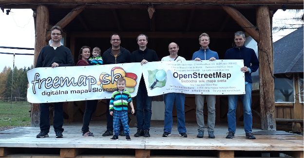
The following post was written by Freemap Slovakia, one of the OSM Foundation Local Chapters.
OpenStreetMap is represented in Slovakia by Freemap Slovakia (NGO Freemap) which was founded in 2009 and became recognized as Local OSM Chapter in 2021.
We have 13 regular and 4 registered members. Apart from the organized members, there are several hundred active mappers in Slovakia.
Over the time, we contributed to OSM in many ways and we continue to do so.
Community
General OSM discussion forum related to Slovakia
We maintain osm_sk google group, available to everyone, where all OSM contributors that deal with Slovakia in OSM are welcome to ask questions and discuss ideas.
Mapping Parties
Once, or twice a year we organize mapping parties, one of which serves as a meeting for our NGO. The parties are always held at different places in Slovakia.
In an effort that has been going for several years we continuously perform supervised bulk import of buildings and addresses from the Cadastre of Real Estate of Slovakia. For this purpose we built a JOSM plugin that allows users to visually inspect batch-imported data and upload it subsequently into the OSM database.
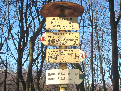
Marked Hiking Trails
Slovakia is a mountainous country and has one of the most elaborate systems of marked hiking trails in the world with more than 100 years of history (shared with Czech Republic).
We cooperate with the Klub Slovenských Turistov (Association of Slovak Tourists) which maintains the physical trails and markings, to make sure all changes are captured in OSM as soon as possible.
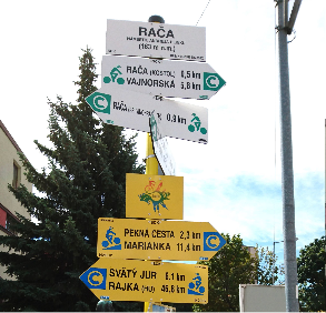
Cycling Infrastructure
Slovakia enjoys steady growth of cycling infrastructure, both in physical means (e.g. dedicated cycling paths) and in terms of trail marking. We make sure the latest changes in the “physical world of Slovak cycling” are captured in the OSM database.
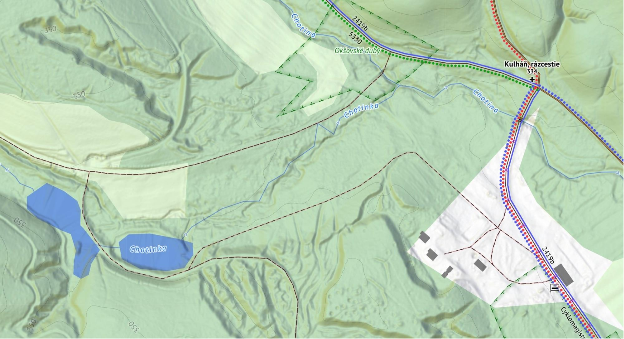
Rivers and streams
Rivers and streams are hard to be properly mapped by “survey”, therefore we imported most of the waterways from the Cadastre of Slovakia, open data sources of Slovak Cartography Office of Slovak Republic, INSPIRE dataset and recently from more precise Aerial Laser Scans of Terrain performed by the Geodesy, Cartography and Cadastre Authority of the Slovak Republic.
Software & Hardware
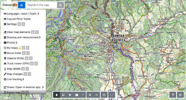
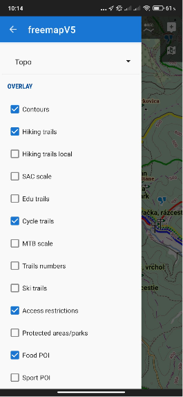
Freemap.sk Web Portal
We develop and maintain web portal freemap.sk that provides a number of features:
Source code of the portal, backend servers and many utility repositories are Open source.
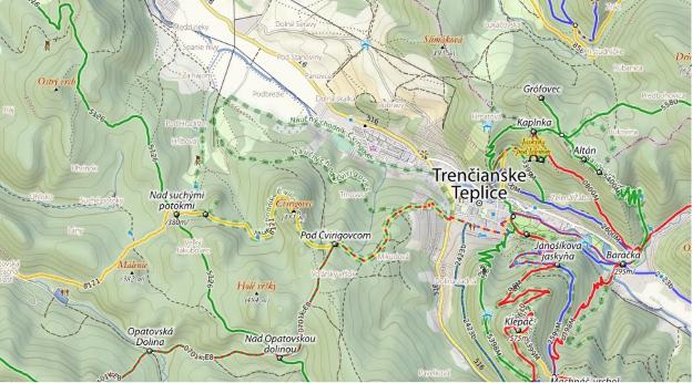
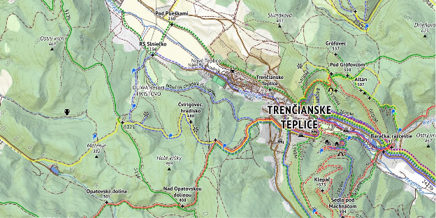
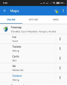
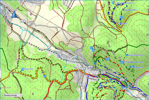
Custom Map Styles and Renderers
Due to the specific appearance of the hiking trail marking in Slovakia, we developed several custom map styles which we also render and provide publicly as tiles.
Legacy Hiking Style
This raster map style was used for many years until we developed a more recent, hi-res “outdoor style”. Some people still consider this legacy style a pinnacle in terms of balance between colours, information and general aesthetics, and therefore the style is still available in the portal.
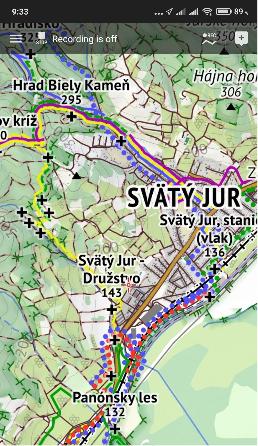
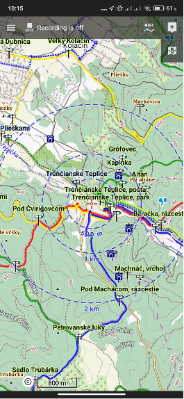
Recent Outdoor Style
A new hi-res raster map style has been in development since 2019, with a more “busy” appearance, as it displays hiking, cycling, cross-country skiing and horse riding marked trails all at once.
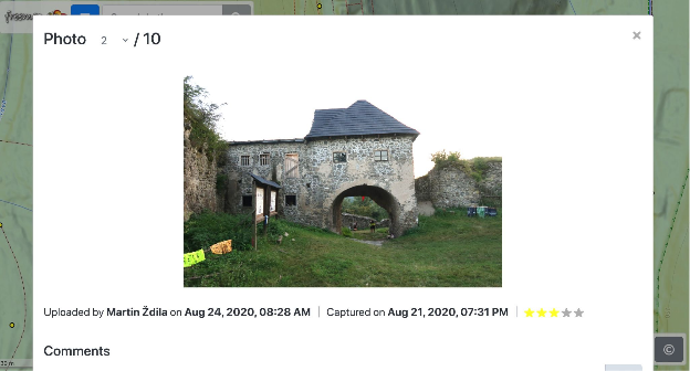
We empower users of freemap.sk to upload and view photos. Our photo gallery contains almost 300 000 photos, including more than 10 000 photos of hiking and cycling guideposts.
Rendering Maps and Hosting Tiles
We render our own map styles and expose the map tiles for public use. This way, anyone can easily use our raster map tiles in their websites, or smartphone apps.
We also provide offline vector maps for the Android smartphone app Locus and other devices:
Garmin Exports
Twice a week we export the freemap-style map into a format suitable for Garmin devices.
Other
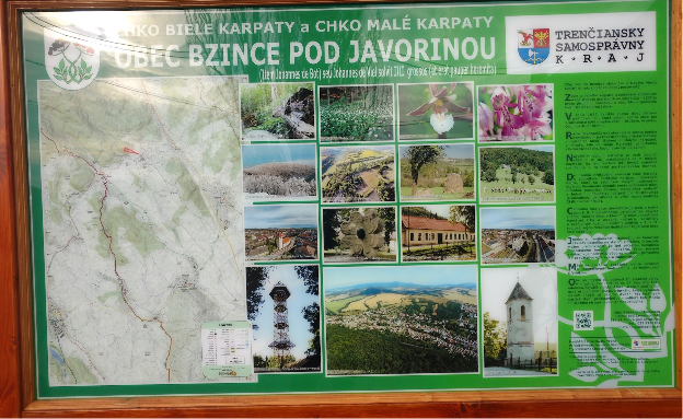
Printed maps
We create custom vector maps for large prints on information boards. Freemap.sk users can also easily export their own raster maps in print quality through the Export Map feature.
OSM License Compliance
Maps generated from the OSM data are frequently used by various NGOs in Slovakia on information boards and printed maps. When we encounter OSM-based maps missing appropriate attribution, we communicate with creators of those maps to make sure the text is included. In almost all cases such the situation is caused by lack of knowledge and not by malicious intent and the problem is usually resolved by adding a sticker to the board containing the attribution text.
Awards
The Openstreetmap Foundation Greatness in mapping award was granted to our member Martin Ždila in 2016.
Funding
Our largest expenses are for hosting the freemap.sk portal and the map rendering servers. These costs are covered with income from annual fees paid by our members, by donations, and via the Slovak government-run 2% income tax donation schema.
Vision for Upcoming Years
In the near future we will be busy with the following:
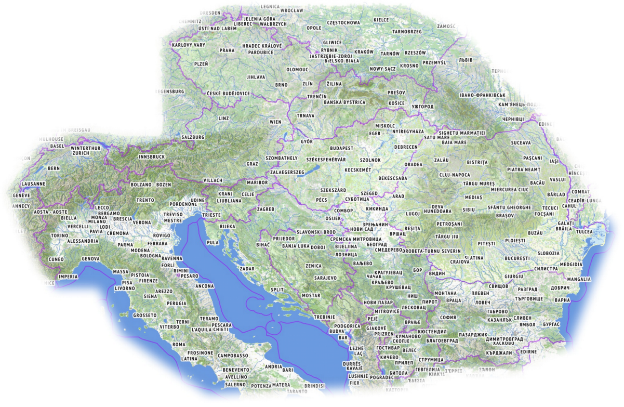
we believe that as a community, we succeeded in creating the best outdoor map of Central Europe, with an unmatched level of detail, precision, and frequency of updates. We plan to continue in this effort
grow the OSM community in Slovakia and make the existing tools more accessible for non-English speaking mappers.
as mostly technology-centric group of people, we realize the need for recruiting new members, who could help us put a more human face on our effort through social media, or by organizing mapping-propagating events for lay people
continue importing data into the OSM database from datasets published by various Slovak government agencies. This also includes cleanup of data that was previously imported from less precise datasets.
work on further development of the freemap.sk web portal, the outdoor map style and a custom routing service, most likely based on GrapHopper
try to raise more funds, which would allow us to grow the area covered by our map even further
oma.sk – partner portal build on top of OSM data and Freemap.sk maps
nabezky.sk – partner portal for cross-contry skiing using Freemap.sk maps
If you would like to contact us
Write us via osm_sk google group, or through Facebook page, or send us an email to freemap@freemap.sk
Do you want to translate this and other blog posts in another language..? Please send an email to communication@osmfoundation.org with subject: Helping with translations in [language]
The OpenStreetMap Foundation is a not-for-profit organisation, formed to support the OpenStreetMap Project. It is dedicated to encouraging the growth, development and distribution of free geospatial data for anyone to use and share. The OpenStreetMap Foundation owns and maintains the infrastructure of the OpenStreetMap project, is financially supported by membership fees and donations, and organises the annual, international State of the Map conference. It has no full-time employees and it is supporting the OpenStreetMap project through the work of our volunteer Working Groups.