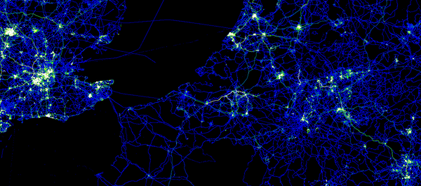
Last year, at about this time, the OpenStreetMap Foundation made a big splash when it released the first Bulk GPS Point dataset. That may have been the largest publication of GPS point data ever. Many users were thrilled to have that raw data and to put it to good use. But they also wanted more. They wanted the track file details.
In fact, requests for bulk OpenStreetMap GPX track files go back to 2007 or earlier. Now, the combined talents of the OpenStreetMap community and the resources of the OpenStreetMap Foundation, make that dream a reality.
Announcing the GPX Planet
The scale of this dataset is fairly large
.
- 848,000 GPX files
- 2.6 Trillion GPX points
- 260GB of GPS data (uncompressed)
Not everybody will be able to manage all of this data at once. It is likely, as with planet
files and planet extracts, that somebody will offer GPX extracts.
What is this data good for?
Well, it’s interesting and there is a large quantity of it. Many OpenStreetMap contributors have been asking for it for years. Previous uses for this type of data have included
- artistic
organic
trip data as maps - confirm turn restrictions
- confirm one-way restrictions
- confirm speed limits
- and many more of your ideas in the comments
The future
There are hopes and plans to improve this service over time, including
- quarterly updates
- addition of vdop / hdop precision data, where available
You can help
You can help to improve this service by contributing your GPX track data. Upload your GPX files through your OpenStreetMap account. Collect new track files as you survey.
You can also help by using the data for something interesting and / or by publishing some code. OpenStreetMap user Zverik has started the ball rolling by creating gpx2pgsql to put the gpx data into your rendering tool chain.
Thanks
Thanks as always to the million-plus OpenStreetMap contributors over the eight years of the project so far. Especially, thanks to the thousands of contributors who collected and uploaded their GPX track files, and to Lars Franke, who wrote the first Java GPX dump code in 2010, and to Ian Dees who rewrote that into the current Python code, and to the many others who were involved in ways large and small.
So, where is it?
Find the GPX planet on the planet site and mirrors.
The image in this article is a visualization of some of the GPS point data in Europe. The image is licensed CC-By-SA and was created by Dave Stubbs.
This post is also available in: Russian


What is the license for this data? Would certain large corporations creating proprietary maps be able to make use of it?
Surely releasing an official torrent is more efficient than the bulk download?
Also, what CycleStreets says.
Get it put up on http://aws.amazon.com/publicdatasets/ and then folks can spin EC2 instances against it w/o having to upload it to the cloud first themselves.
OSM wiki page https://wiki.openstreetmap.org/wiki/Planet.gpx
and regional extracts http://zverik.osm.rambler.ru/gps/files/extracts/index.html
On the question of the license, I see there is some (inconclusive) discussion at:
http://lists.openstreetmap.org/pipermail/talk/2012-September/064106.html