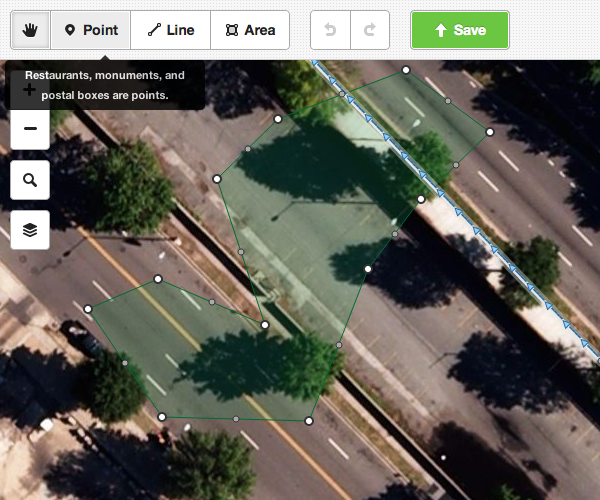
Back in July I wrote about building a new, friendly map editor for OpenStreetMap in JavaScript. Since then, and in particular in the last two months, the project has come on in leaps and bounds – and today marks the first alpha release.
Codenamed iD, it aims to provide an easy-to-use, comfortable editing environment for the OpenStreetMap newcomer that’s nonetheless fully featured – you’ll be able to edit any OSM data with it. Clear modes such as “Move map” and “Add point” make it easy to get started without having to read swathes of instructions.
So – try it out! You can play with a working instance at geowiki.com/iD. It’s connected to a test database, not the main OpenStreetMap database, so don’t worry – you won’t break anything.
If you find a bug, use github to check it’s not already been reported, and file one if not.
The fast progress over the past few months is entirely down to the work of Tom MacWright and Saman Bemel Benrud, John Firebaugh, and others. Some of them have been funded to work on this by a Knight Foundation grant from the Knight News Challenge programme.
As ever with OpenStreetMap, the code is fully open source, and we’re looking forward to the community getting involved with helping to build the project. For the first time since OSM was founded in 2004, this will give us a full suite of editing tools – iD and mobile tools for new users, Potlatch 2 and Merkaartor for intermediate editing, and JOSM for power users – so that anyone can bring their local knowledge to the map, whatever their expertise.
Read more about the alpha release in Tom’s blog post.


Great news.On a side note I think that the tool tip is a little bit misleading, IMHO everything bigger then say a square meter is better mapped as an area, so monuments and maybe also restaurants are not typical node objects (maybe phone booths would make a better example, even if they get quite rare recently with everybody running around with cell phones).
if iD is targeted towards new users, suggesting they trace anything larger than a phone booth right off the bat seems like the wrong way to ease them into OSM, not to mention impractical in areas without really good imagery.
Wow! This is really great news and a really good start. Potlatch 2, the flash-based online editor for osm.org, works great but the fact that it’s flash-based has been a long standing issue.SVG + JavaScript is the perfect replacement for this and I’m really happy to see that there’s quality work happening here.Questions: 1. Are you planning on including features for loading GPS traces too? 2. Is there a way to contribute here, financially, I mean? I’m a little bit involved in FreedomSponsors.org which may be a possible source of some donations for specific features. (Kinda like Kickstarter but down to individual features.)