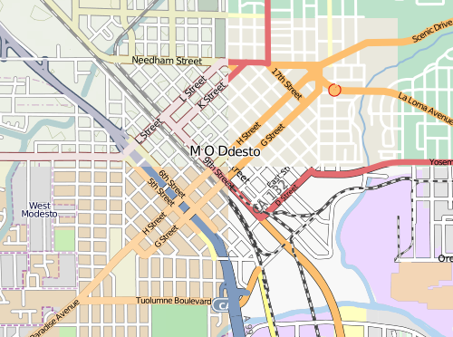
The image above was inspired, in part, by Firefishy’s April Fools Day joke, OpenWhateverMap. While such a map is unlikely to be used for an ordinary application, it does serve to show the wide variety of renderings of OpenStreetMap data that are created by the OpenStreetMap community and displayed on the OpenStreetMap web site. It also serves as an illustration of one of the frequently asked questions about the OpenStreetMap.org web site.
How are maps added to the OpenStreetMap web site?
Until December 2005, the OpenStreetMap web site did not have a map shown at all.
Starting in December 2005, maps have appeared on the OpenStreetMap web site. Today, the slippy map
is the most prominent feature of the OpenStreetMap web page. Currently there are four rendering layers that can selected on the front page as well as one overlay layer.
The OpenStreetMap Foundation now has published guidelines for tile layers to be considered for inclusion on the OpenStreetMap web page. If you know of an interesting rendering of OSM data, and you think it should be considered as a Featured Layer, add your suggestion to the featured tiles score card and start the discussion.
The proposed layers will be evaluated for suitability by the Technical Working Group, periodically, and the tile layer that you recommend could be featured on the OpenStreetMap web site.
This post is also available in: French


