Monthly Archives: March 2011

Weekly OSM Summary #14

March 20th, 2011 – March 31th, 2011
A summary of all the things happening in the OpenStreetMap world. We’re sorry that this issue is late and brief again, but we (especially Pascal) are caught up in organising the last bits for the upcoming FOSSGIS conference, the German OpenStreetMap conference.

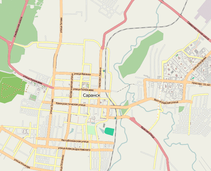
  • “The city Saransk was mapped in only 50 hours. User osmisto has organized the first Russian online mapping party: it’s still cold outside, so almost everyone attended.” Here’s a video showing the progress – impressive!
  • China is imposing stricter roles against online map services (People’s Daily online). It’s unclear how OSM will be affected by this.
  • Recent improvements to the Mapnik style now make it render e.g. driveways and labels for florists.
  • Jochen Topf writes about new ways to make map renderers. He suggests to build smaller toolkits that can be combined; he already started a few experiments in code.
  • Martijn von Exel has made a tutorial for a self-updating local OSM extract.
  • Harry Wood created a bus map for London.
  • The future of areas?!
  • The OSM Inspector made by the Geofabrik has been moved to faster hardware. Also new is the multipolygon problem view.
  • Cyclestreets is celebrating their second birthday and take a look back at the last year in their blog.
  • OSM-3D made by the University of Heidelberg has been updated to include a virtual globe and is now covering most of Europe.
  • This wiki page is great resource to learn more about mapping buildings with aerial imagery.
  • ITO Map (mentioned before) is now available globally.
  • A new, second beta of Maps4Macs has been released. Improvements include a better search syntax, support for PBF files and live track display when recording a GPS track.
  • Show Your Journey (syj) is a website to share routes. The new version now supports the upload of complete routes (as GPX or KML).
  • Safety Maps – Make and share maps of safe places to meet in the event of an emergency.
  • Version 0.2 of the Open Source Routing Machine (OSRM) has been released with lots of improvements.
  • A small python script to generate posters of Cloudmade map tiles.
  • Mapjumper is a Chrome extension to easily jump from one online map provider to another.”
  • Imposm is an importer for OpenStreetMap data. It reads XML and PBF files and can import the data into PostgreSQL/PostGIS databases.

Authors: Jonas, Pascal & Dennis
Did we miss something? Do you want to help us collecting the news for next week’s issue?
You can contact us via mail or Twitter.

Project of the Month: Marketplace – Food Month

Where do you go for a really delicious tomato? To your garden, of
course, but between seasons you might be limited to tomatoes shipped
well before they are ripe, from another country, or another
hemisphere. Unless you know about a farmers’ market or a roadside
stand where you can get a local hot house tomato.

Local food and food supply have been in the press recently. This
month, we look at various aspects of the food supply chain.

We map marketplaces and farmers’ markets for the Project of the Month of April 2011

This is your Project of the Month. Make suggestions. Inspire other
mappers. What is it about contributing to OpenStreetMap that
interests you? Postboxes? Bowing alleys? Share your OpenStreetMap
interests by suggesting a Project of the Week or Project of the Month.

The current Project of the Month: Bridge and Tunnel continues until the end of March.

Marketplace photo by Chas Redmond is
licensed CC-By

Project of the Week: Department Store

A department store sells a wide variety of durable goods for the home.
Large and small appliances, furniture and kitchenware may each have
large sections or departments of the store. Clothing
departments may be further divided by customer and use, such as Infant
and Toddler or Outdoor clothing. The departments will continue,
perhaps with jewelry and cosmetics or sporting goods.

The Project of the Week is to add local Department Stores to the map.

This is your Project of the Week. Make suggestions. Inspire other
mappers. What is it about contributing to OpenStreetMap that
interests you? Postboxes? Bowing alleys? Share your OpenStreetMap interests by contributing a Project of the Week.

Department store exterior photo by Aaron is
licensed CC-By.

Image of the Week: Tube Time Travel

Media_httpwikiopenstr_eovcf

Tom Carden’s Travel Time Tube Map creates isochronic maps of the London Underground.

This is a Featured image, which means that it has been identified as
one of the best examples of OpenStreetMap mapping, or that it provides
a useful illustration related to the OpenStreetMap project.

If you know another image of similar quality, you can nominate it at

http://wiki.openstreetmap.org/wiki/Featured_image_proposals

Weekly OSM Summary #13

March 9th, 2011 – March 20th, 2011
A summary of all the things happening in the OpenStreetMap world:

  • After the terrible earthquake and tsunami in Japan, the OSM community started efforts to provide up-to-date maps of the affected region for search-and-rescue teams and other relief organizations. Information on how to get involved can be found in the wiki here; the main discussion platform is the HOT mailing list and the IRC. HOT was able to get access to post-earthquake imagery to map flooding, damaged roads and buildings. As you can see on the wiki page, the community also created special Garmin maps for download and maps highlighting things like the road status (passable/impassable).
  • Kate Chapman has created some stats on the activity in Japan and Christopher Osborne did some visualizations.
  • Even the Haitian OpenStreetMap mappers are contributing to the crisismapping efforts for Japan and Libya. You can do it too!
  • Leigh Hunt has made an animation (gif) of the editing activity of the OSM community in Christchurch, NZ after the earthquake.
  • The deadline for the Call for Papers for this years SOTM conference in Denver has been extended.
  • The OpenStreetMap-Foundation blog gives you a summary of all the different Working Groups that are available for February 2011.
  • A new script osm2postgresql imports OSM data into a PostGIS db. For example, it improves the rendering in QGIS.
  • A new version of the WordPress OSM Plugin (German article) is available. It improves some bugfixes and is campatilbe with WP 3.1.
  • Pascal wrote a blog post about the “Growing agreement of the new Contributor Terms and about relicensing OpenStreetMap data (-Update-)”.
  • Osm2xp is a scenery generator for the X-Plane simulator. Using OSM data, it will generate 3D buildings into X-Plane, each one with its real location and real shape.
  • “MapQuest is providing several address files that contain user-provided latitude and longitude locations across the world. Our users provided these exact locations to us so that they could be mapped correctly on our MapQuest maps.”
  • Skidea is offering special Garmin maps for ski resorts.
  • Matt Williams built a postcode finder based on OSM data.
  • ITO has launched ITO Map – “A new map overlay service for OpenStreetMap”. The different overlays do a great job in highlighting the diversity and richness of OSM data.
  • OpenStreetMap was accepted for the Google Summer of Code. All the ideas are collected in the wiki here.
  • A blog post about the security and ethics of live mapping in repressive regimes and hostile environments.

Authors: Pascal, Jonas & Dennis
Did we miss something? Do you want to help us collecting the news for next week’s issue?
You can contact us via mail or Twitter.

Deadline extended for State of the Map call for papers

The State of the Map call for papers deadline has been extended through June 15, 2011, giving more time for great papers to be presented to the selection committee. There has been a great response for topics from several countries and we want to make sure the opportunity to be apart of this years conference is open to those who are still formulating talks.

The OpenStreetMap Foundation invite contributions from mappers, academics, geo-hackers and open geodata supporters around the world. If you are involved in OpenStreetMap mapping, coding or community organisation – or if you want the chance to present your ideas or opinions to the OpenStreetMap community, you should submit a paper to the State of the Map 2011!

More information on the Call for Papers


Project of the Week: instrument shop

What I really need, right now, is an ukulele. I could order one,
overnight from the on-line ukulele store, but I need it now, and
prefer to shop locally. Let’s just have a quick look at the map.

What’s that you say? Steve’s Ukulele Kwikee Mart, is right round the
corner? How convenient.

The Project of the Week is to add your local musical instrument shop.

This is your Project of the Week. Make suggestions. Inspire other
mappers. What is it about contributing to OpenStreetMap that
interests you? Postboxes? Bowing alleys? Share your OpenStreetMap interests by contributing a Project of the Week.

Guitar Lineup photo by Orin Zebest is
licensed CC-By

Image of the Week: Saransk Mapping Party

Media_httpwikiopenstr_fxhpa

OpenStreetMap contributor osmisto has
organized the first Russian online mapping party: it’s still cold
outside, so almost everyone attended. Find out more and see a larger animation from the Саранск (Saransk) mapping party.

This is a Featured image, which means that it has been identified as
one of the best examples of OpenStreetMap mapping, or that it provides
a useful illustration of the OpenStreetMap project.

If you know another image of similar quality, you can nominate it on
Featured image proposals.

http://wiki.openstreetmap.org/wiki/Featured_image_proposals