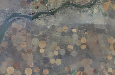
A small sample of the South Africa aerial imagery provided by CD:NGI, the mapping agency of the government of South Africa.
OpenStreetMap contributors in South Africa have negotiated with the South African government to arrange the donation of some aerial imagery to be used in creating and editing data for OpenStreetMap. Chief Directorate: National Geo-Spacial Information, or CD:NGI, part of the South African Department of Rural Development and Land Reform, have provided aerial imagery and OSM contributor Grant Slater, has prepared it for use in our editors. There is 3TB of imagery and covers all of South Africa.
Thanks as always to the many people who helped make this happen: the fine folks at CD:NGI, the OSM contributors who carried the data between continents, and the mappers who continue to make OSM data better, more up to date and accurate every day.
You can find more information about this aerial imagery in the thread on the talk-ZA mailing list.
Do you want to donate aerial imagery or other data to OpenStreetMap? Contact the OSM Foundation Communication Working Group for more details. communication@osmfoundation.org
The OpenStreetMap Foundation is a not-for-profit organization, formed in the UK to support the OpenStreetMap Project. It is dedicated to encouraging the growth, development and distribution of free geospatial data and to providing geospatial data for anyone to use and share. The OpenStreetMap Foundation owns and maintains the infrastructure of the OpenStreetMap project. You can support OpenStreetMap by donating to the OpenStreetMap Foundation.
