Hello OpenStreetMap-pers,
The change to ODbL is imminent. No, Really. We mean it.
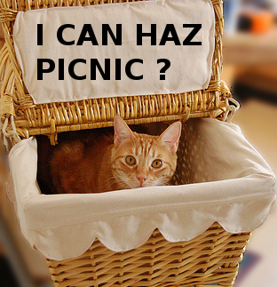
At long last we are at the end of the license change process. After four years of consultation, debate, revision, improvement, revision, debate, improvement, implementation, coding and mapping, mapping, mapping, it comes down to this final step. And this final step is an easy one, because we have all pitched in to do the hard work in advance. The last step is so easy, it will be a picnic.

On Wednesday, 12 September 2012[1], generation of the next Planet file will begin. At that point, the API will switch over to ODbL and OpenStreetMap will be an ODbL-licensed Open Data project. API transactions and diffs consumed after that point will consist of ODbL-licensed OpenStreetMap data.
About thirty hours later, that newly-generated planet file will be available from planet.openstreetmap.org for you to consume with your renderers, routers, QA systems, convertors and re-imaginers.
You won’t want to mix ODbL diffs with old license planets or diffs. Purge and reload your systems with the ODbL planet. Then consume the ODbL diffs. Planet will have a new directory structure. We’re taking this opportunity to rationalize the layout of planet directories a bit. You should find it easier to understand afterwards. This also means that you won’t accidentally mix data of different licenses.
Mappers
Mappers shouldn’t see a difference and won’t have to change their mapping. Continue to improve OpenStreetMap by mapping from your own survey observations and using OSM-approved external sources. Never copy from other maps.
Data consumers
If you consume OpenStreetMap data and publish it, we have some guidance for you on the wiki. You’ll want to consider your obligations under the new license and then proceed to purge your old data and switch to the new. Many consumers, such as custom renderers, will only need to update their attribution of OpenStreetMap to the new simplified attribution.
Data consumers may time their upgrades to the new planet and diffs at their convenience.
Best regards and happy mapping,
The Communication Working Group
[1] in case of rain, we won’t cancel this picnic, just reschedule it for the subsequent Wednesday, 19 September 2012.
Image credit
Photo of cat in picnic basket is © Jacob Davies, licensed CC-By-SA.
This post is also available in: Japanese

Pingback: de.straba.us – Con un pic-nic i dati di OpenStreetMap passano definitivamente alla ODbL